Author: H. Benjamin
-
Measure and Display Air Pollution with HDmaps | Live-Demo
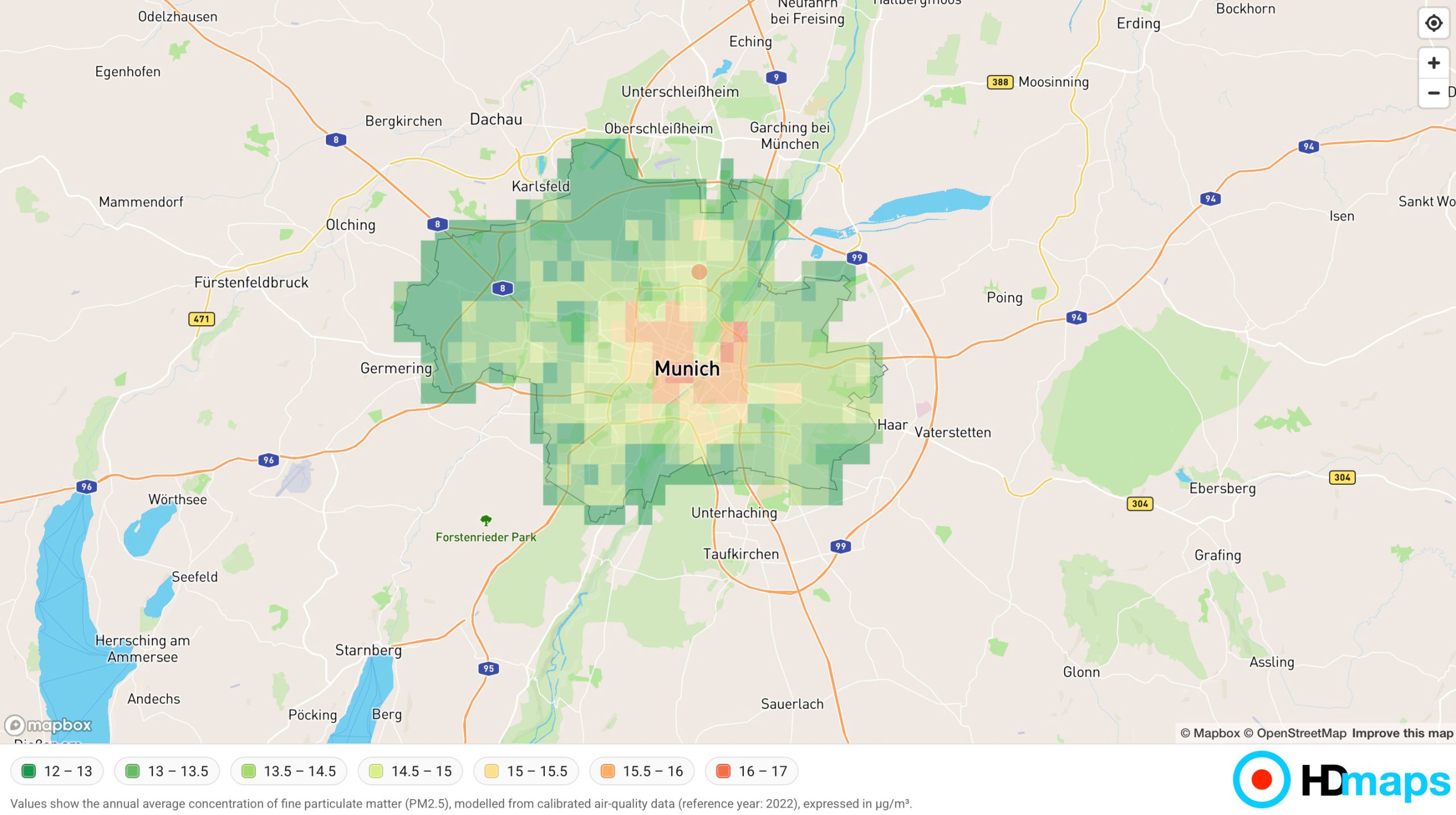
Understanding air quality is no longer optional—it is a critical factor in urban planning, real estate decisions, and public health awareness. With HDmaps, measuring and presenting air pollution becomes a seamless, visual, and actionable experience. Turn Complex Data into Clear Visual Insight HDmaps functions like a CSS layer for maps—a flexible framework that allows you to design, … >> Read more
Written by
-
HDmaps at ITB Berlin 2026: Bringing Location Intelligence to Travel and Hospitality
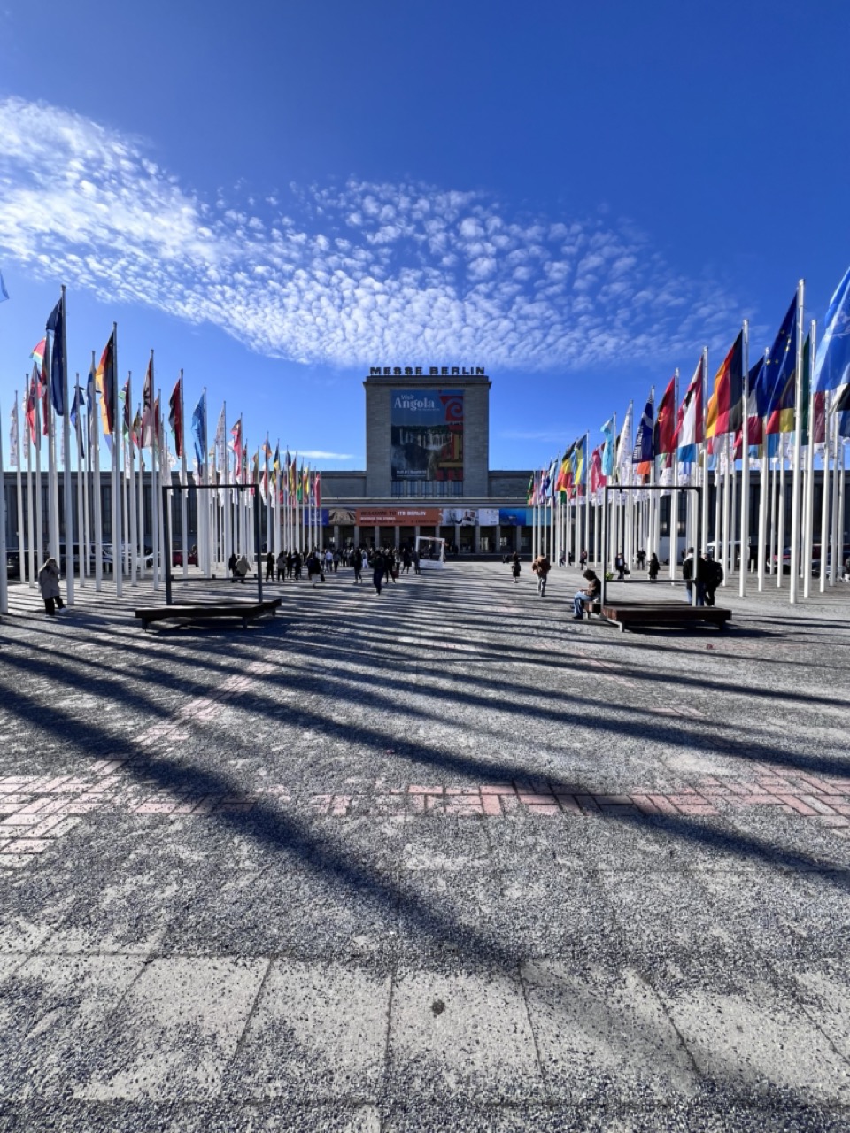
At ITB Berlin 2026, one of the world’s leading travel industry events, conversations with hotel chains, travel agencies, and corporate travel teams revealed a consistent theme: location intelligence is becoming a core differentiator. Travel decisions are no longer based solely on price and availability. Guests and operators increasingly consider environmental quality, accessibility, and neighborhood dynamics. This is where … >> Read more
Written by
-
Make Light Pollution Actionable | HDmaps Live-Demo
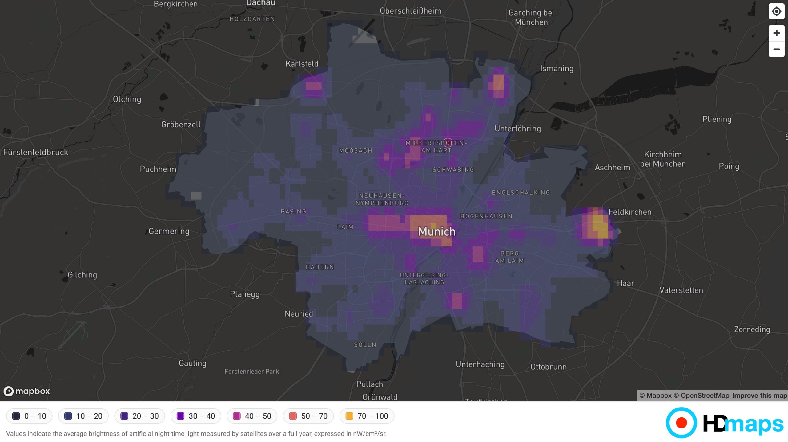
HDmaps turns light pollution into a visible and actionable metric. By combining flexible visualization, layered data, and easy integration, it enables organizations to better understand and communicate environmental impact—where it matters most. Light pollution is an increasingly relevant factor in urban environments—impacting ecosystems, human health, and overall location quality. With HDmaps, measuring and visualizing light pollution becomes … >> Read more
Written by
-
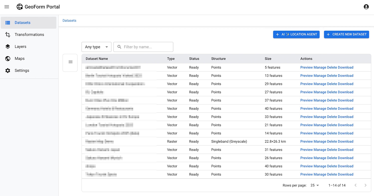
AI Location Agent – From Text to Interactive HDmaps with new GeoForm.io feature
At HDmaps.eu, our mission is to make geographic data easier to create, understand, and share. With our new “AI ✨ Location Agent”, GeoForm.io takes a major step forward:Turning text into an interactive map — fully automatic. What is the “AI Location Agent”? The AI Location Agent is an AI-powered feature in GeoForm.io that transforms unstructured text or multi-page … >> Read more
Written by
-
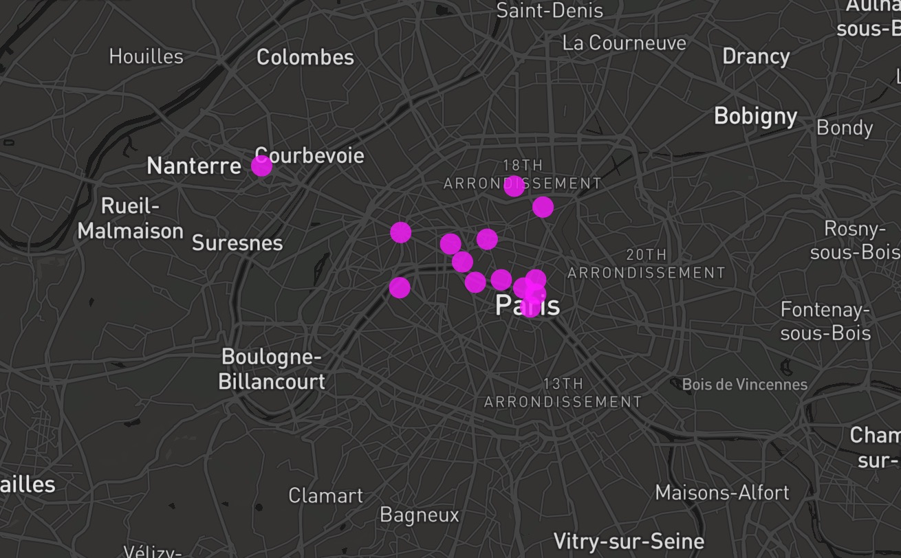
Paris @ Night – HDmaps Dark Map Live Demo
Not sure what to visit in Paris as a tourist? Here are some suggestions! Explore in this interactive map some hotspots and must-see-locations in the French Capitol — powered by HDmaps Dark Map style à la “Paris @ Night” mode. 🙂 Touristic Hotspots Ever wanted to visit France, especially Paris, here are some suggestions from … >> Read more
Written by
-
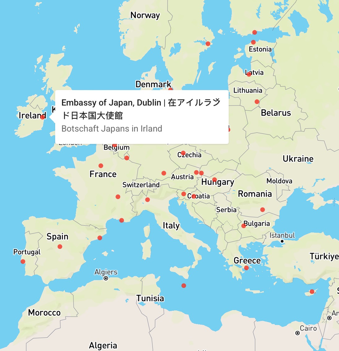
Street Map — Japanese Embassies in Europe
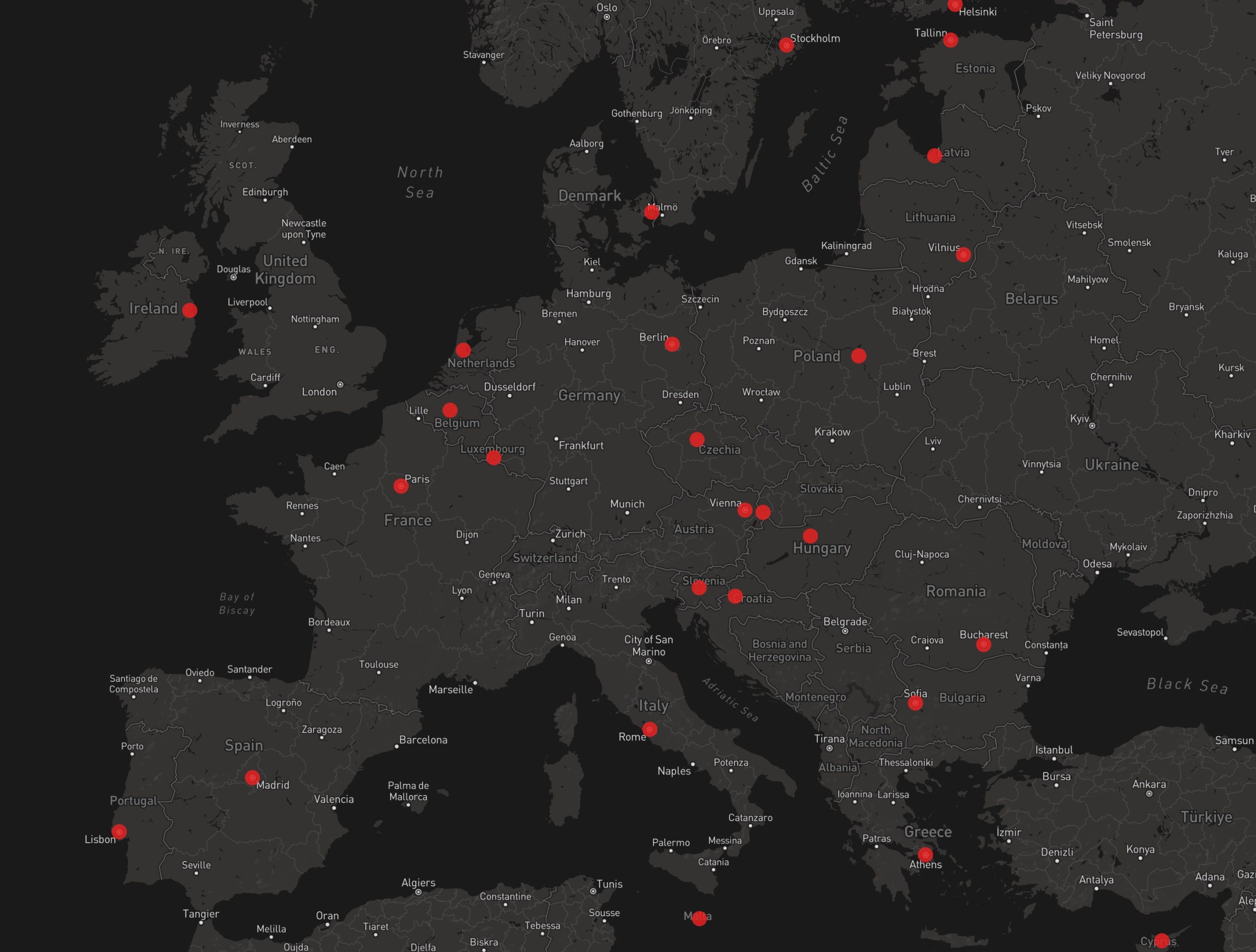
Explore an interactive map highlighting all Japanese embassies across EU member states — powered by HDmaps Street Map style. Diplomatic Presence Visualized Japan maintains an extensive diplomatic network throughout Europe, supporting cultural exchange, trade, and international cooperation. This Street Map demo visualizes all embassy and consulate locations in EU countries using HDmaps’ detailed Street Map Style, … >> Read more
Written by
-
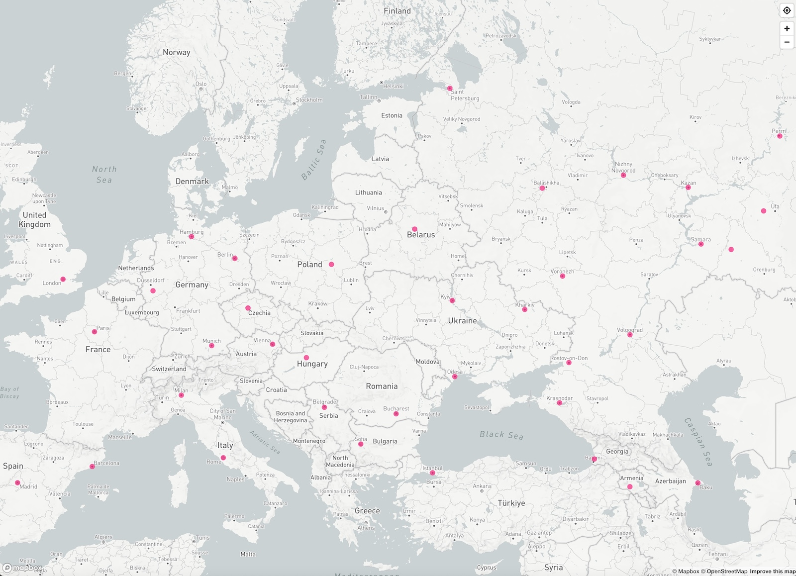
Light Map — Europe’s Megacities
Discover the major metropolitan areas of Europe in a clean, high-contrast map view designed for clarity and performance. Visualizing Urban Scale Europe is home to some of the world’s most densely populated and historically rich urban areas. This demo showcases cities with more than one million inhabitants, using HDmaps’ Light Map Style — a design that emphasizes … >> Read more
Written by
-
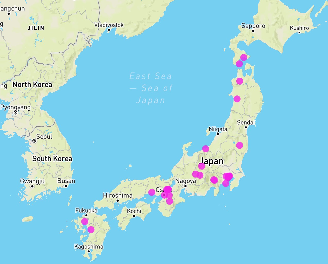
Outdoor Map — Sakura / Hanami in Japan
Experience Japan’s famous cherry blossom season in a new way — explore live Hanami locations and bloom timing on our interactive HDmaps Outdoor Map. Mapping Japan’s Bloom Season The HDmaps Outdoor Map demo showcases Japan’s famous cherry blossom, known as “Sakura”, during the spring season. The tradition of Hanami — literally “flower viewing” — has been celebrated for … >> Read more
Written by
-
Dark Map — EU Capitals
Experience HDmaps’ Dark Map style — a night-mode inspired visualization featuring all 27 capitals of the European Union, complete with demographic and geographic insights. Night Mode Visualization The Dark Map style from HDmaps offers an elegant, high-contrast presentation perfect for dashboards and modern interfaces. This demo visualizes all 27 EU capitals — from Lisbon to … >> Read more
Written by